May 20, 2014

New Zealand Cycle Touring Route - Black Forest Station to Albury

Mackenzie pass is a back country route that is not a main road and is shingle and there is a steady but not to demanding climb out of the Mackenzie Basin through the pass. The pass leads to Albury which is a small village with a pub in the southern part of the Canterbury region. The ride is 70ks long and takes you through the fantastic Mackenzie Basin back country landscape with few people and minimal traffic.

We went through in March and overnight there was a dusting of snow.

In the McKenzie Country

Deserted country roads


May 19, 2014

,

New Zealand Cycle Touring Route - Otematata to Black Forest Station


This cycle touring ride is on  a private access road so permission of the owners is required and because of the altitude reached there is often snow and the road is then closed.

Contact: Black Forest Station
Contact Persons: Ben and Caroline Innes
Phone: 03 680 6795

As the road reaches a height of 900m the road can be subject to sudden changes of weather so you need to do it in the summer and take adequate warm clothing. The surface in places is steep and rough and it is a challenging bike route and really only suitable for mountain bikes with light loads. We found that for a fully loaded touring bike the ascent involved a good deal of pushing. This route is only 35kms long but will take most of the day.

The route is attractive because it is in a sparsely populated back country area of the South Island and the route takes you from Otematata into the Mackenzie Basin.

You can then continue north to Geraldine on the McKenzie Pass.

Lake Benmore

Access Road

Lake Benmore

Road over the Saddle

Black Forest Station


May 18, 2014

,

New Zealand Cycle Touring Route - Queenstown to Mossburn

This cycle ride begins with a ride on the TSS Earnslaw which is a 1912 Edwardian vintage steamer which takes you across Lake Wakatipu to Walter Peak Station which is a great way to start the day.
The ride allows you to experience the joys of the New Zealand back country where the roads are shingle and there are few cars or people. It is only 58kms to the Mavora Lakes but there is a significant climb to do on the way.

 At the Movora Lakes there are camp sites on the lakes edge and the while the lakes are famous for the sandflies we did not have any problems. There were tame South Island Robins hopping around our feet.

The next day we rode to Mossburn which was 60kms along a mostly shingle on a quiet road.

Lake Whakatipu from TSS Earnslaw
TSS Earnslaw

On road to Mavora Lakes
Oreti River
Mavora Lakes

South Island Robin


May 17, 2014

,

New Zealand Cycle Touring Route - Arthurs Pass - Greymouth to Christchurch

Arthur's Pass is the central one of the three road crossings of the Southern Alps. The others are Lewis Pass, some 100 km to the north and Haast Pass, 230km to the south.


Arthur's Pass is also the name of a town on the crossing which is 95km from Greymouth and 140km from Christchurch. Arthur's Pass is also the National Park by the same name which is very popular for tramping/hiking, skiing and mountaineering. The road and its environs are spectacular and make the crossing on a bike a memorable but arduous journey.

 Although the most direct access to Arthur's Pass from the West Coast is via SH73 up the Taramakau River Valley, there is an alternative route via Lake Brunner and this is an attractive option for cyclists.

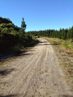
The Lake Brunner option involves an overnight stop at the small rather cute township of Moana on the shore of Lake Brunner. This is a good days ride from Greymouth, along a lightly trafficked road that follows much the same route as the trans alpine railway.  The countryside is river valley with some dairy farms, scrub country and pine forest. Facilities at Moana include a camping ground, two pubs and a very small convenience store.

From Moana the route to Arthur's Pass joins SH73 at Jacksons on the Taramakau River where there is a camping ground, a pub and very little else. SH73 continues up the main river valley for a while before leaving this and branching off up the Otira River to the tiny settlement of Otira. This is where road leaves the valley and the serious climb to the pass begins. Steep grades on a winding road that includes an overhead avalanche chute across the road, and then the impressive 500 metre long Otira Viaduct. 

This takes you high above unstable scree slopes below and up into kea country. The kea is a mischievous New Zealand native parrot that lives in the high country and delights in stripping rubber window seals from parked cars and pecking day packs, bike seats and panniers given the opportunity. 


Keas at work

The pass is eventually reached (at 920 metres above sea level) and then its downhill to your overnight stop at Arthur's Pass Village or the Bealey Hotel, a few km further on.

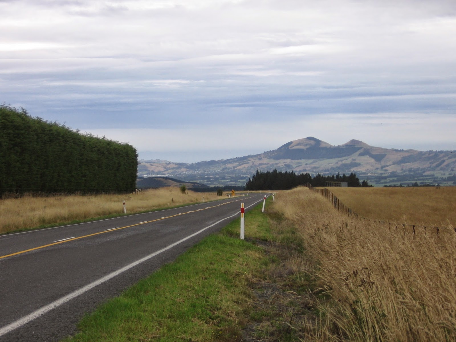
The next day’s ride passes through open rolling alpine country for the first 65 km. This is a tussock landscape with accompanying rivers and lakes, and has some spectacular limestone outcrops and formations. Some of this land is still being farmed as high country sheep stations. There is a cafĂ© at Flock Hill which is worth stopping at because beyond this is a section that has the steepest climb of the day.
When Porters Pass (at 950 metres) is reached, the descent to the Canterbury Plains begins. It’s downhill all the way 19km to Springfield for the nights rest at the Springfield Hotel.
The next day the road descends gradually to the Canterbury Plains and across these on long straight stretches of road all the way to Christchurch.


May 13, 2014

,

New Zealand Cycle Touring Route - Rotorua to Cambridge and Return

The idea behind this ride was to do a round trip from Rotorua that included parts of the Rotorua Bike Trail and the Waikato Bike Trail.
In planning the route the main challenge was the section of the main highway between Tirau and Rotorua which was considered to busy to be included so an alternative route was chosen.

Cycleway heading south out of Rotorua

The ride started by using the Rotorua Bike Trail that starts by Lake Rotorua and heads south alongside the main highway. The bike trail is mostly concrete and is separated from the road which is great as it is a busy highway.


The route follows the Rotorua Bike Trail up to Waimangu (26ks from Rotorua) and past Lake Oharo before turning right onto State Highway 38 and then onto State Highway 5 heading south before proceeding to Waiotapu. The ride then goes on Waikite Valley Road to Lake Ohakuri and then to Ongaroto Road. Follow this road to Whakamaru and then Mangakino. It is a total of 114ks from Rotorua to Mangakino. There is ample accommodation available in Mangakino.


As already outlined the ride was planned to include the Rotorua and Waikato bike trails but this proved impractical because the Waikato Bike Trail is not continuous and is more suited to mountain bikes.There is a section of the Waikato bike trail from Whakamaru to Mangakino which gets you alongside the river and is manageable on touring bikes.
In most places on the route the road had sufficient space for bikes and there was minimal traffic.

The next section of the ride is from Mangakino to Arapuni on the Waipapa Road which is a distance of 50ks and includes a significant climb in the middle and a long downhill at the end. Once you have reached Arapuni there are options to choose from. You can ride 14kms into Putaruru or continue on to Cambridge which is a further 40kms.

We went to Putaruru and left out the Cambridge section and headed out of Putaruru for 10kms on the main road to Whites Road and then turned into Leslie road which is the alternative route back to Rotorua via Mamaku. It is 27ks from Whites Road to Mamaku and a further 20.5ks into Rotorua.If you go on to Cambridge you can link back to Leslie Road easily and are only on the main highway for a short time.

Leslie Road leads up through the forest and starts of as a sealed surface but conditions deteriorate as you head up the road with a short stretch of the road being to boggy to ride. As an alternative route to the main highway it is interesting although challenging.


On the cycleway

Leslie Road


May 10, 2014

,

New Zealand Cycle Touring Route - Dunedin to Middlemarch

It is 80.4kms from Dunedin to Middlemarch and 64.3kms from the Dunedin Airport to Middlemarch. There is an option of going by train from Dunedin to Pukerangi and then cycling the remaining 25kms to Middlemarch. Middlemarch is the start of the Otago Rail Trail.

If you are going to cycle all the way from Dunedin to Middlemarch this ride cannot be treated as an easy warm up ride for the Otago Rail Trail as there are some significant hills to contend with on this ride. There is a pub at Clarks Junction which is 50.3kms from Dunedin.

Dunedin to Picton Video