Showing posts with label South Island Cycle Touring. Show all posts

April 23, 2015

,

New Zealand Cycle Touring Route - Hamner Springs to Reefton

This route at the top of the South Island is an option to get from the east coast of the South Island to the west coast if you are heading that way. It is also one of the best rides in the South Island.
From Hamner Springs the road leads you to the Lewis Pass and includes beach forest and mountain scenery especially after the Engineers Camp which is 50 kilometres from Hamner Springs. After a steady 4kilometre climb you arrive at the Lewis Pass which is the most northern crossing of the Southern Alps into Westland. The reward after taking in the views is a long downhill ride to Maruia Springs, where there is a small settlement with a shop where you can have coffee and stock up on previsions.
After a few kilometres the road climbs over a low saddle and then there is approximately another 40 kilometres of mainly downhill riding in beautiful scenery again in mature beech forest with mountains as a backdrop. Reefton is a well-established gold and coal mining town with a backpackers and all amenities.


Towards Reefton

Reefton
South Island Robin

April 04, 2015

, ,

New Zealand Cycle Touring Route - Middlemarch to Clyde

The Otago rail trail is 150 kilometers long and extends from Middlemarch to Clyde and can be easily fitted into your cycle touring ride. The surface of the trail is not perfect but can be negotiated on a touring bike provided you are not trying to cover the distance to quickly.

The Otago rail trail has become a very popular ride especially for those just taking up cycling. This is because it is off the road and as it is on an old railway the grades are not too steep and also because there are lots of cafes and accommodation along the way so that you can do shorter distances if you are not yet ready to do 80ks a day or want to take more time enjoying the countryside.

The central Otago landscape is distinctive and is well worth riding through provided it is not in the middle of winter when it can be very cold with a good chance of bad weather including snow.


March 27, 2015

South Island Cycle Touring


The topography of the South Island is similar to the North Island although the Southern Alps form a much more formidable barrier between the east and west coasts. There are a number of passes that cross between the two coasts including Haast, Lewis, Arthurs, Lindas and Porters pass.

The link shows the topography of the South Island.


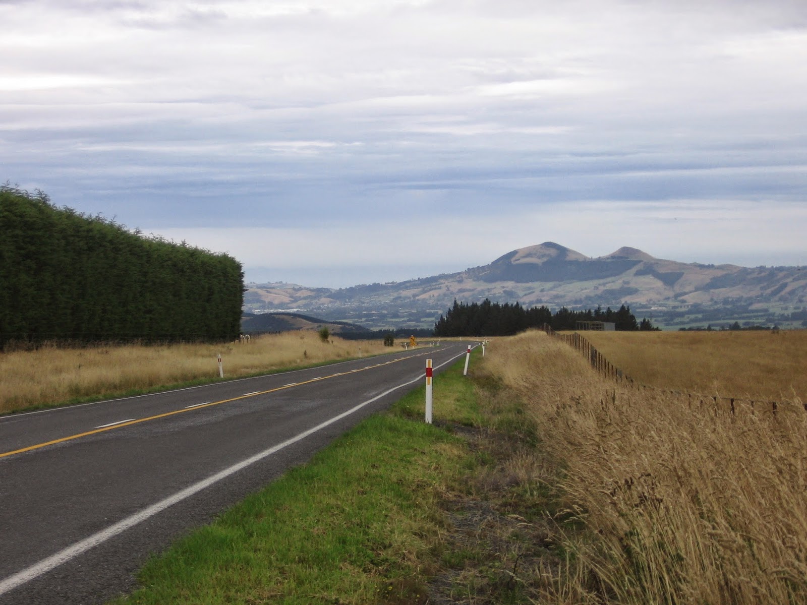
There are attractions on both coasts of the South Island which makes it difficult to include all the highlights in a cycle tour. On the east coast Kaikoura is a interesting place to visit with its whale watching and abundant sea life. The coastline on the way to Christchurch (180k) is an attractive road to ride on with a stunning coastline but as it is the main highway to Christchurch it can be very busy. There is the option of going down the state highway to Cheviot or instead going on the inland Kaikoura Road.  

On the East coast you can head to the Mt Cook area including the MacKenzie basin which is spectacular place to ride in using the Christchurch to Queenstown scenic route rather than using the busy main highway. If you ride down the East coast then there is the option of returning to Picton down the Haast pass and back up the west coast.

When you are planning your South Island tour you need to decide if you want to venture into the back country. The New Zealand back country is a unique environment with magnificent scenery but as always there is a price to pay. The roads are mostly shingle and so you need a suitable bike with adequate tires to cope and there are also lots of hills with some significant climbs.
The Nevis Valley ride from Garston to Bannockburn is well worth including in your south island tour.

You can travel by the TSS Earnslaw from Queenstown across Lake Whakatipu to Walter Peak Station and then on the gravel road to the Mavora Lakes and then via Garston on the Nevis Valley Road to Bannockburn. This takes you into the isolated and beautiful back country where there are few people or cars. The road goes up over the Duffers Saddle which at 1,300 meters is a significant climb. There are also over 20 fords to negotiate on your way so a fully laden touring bike is a challenge.  
 
Another back country ride to consider is the Rainbow Road and the Molesworth Station. This is located at the top of the South Island. For this ride into New Zealand's largest farm you need to be self sufficient as there are no shops but although there are times when the the road is steep and and rough and there are lots of hills the south island back country is well worth the effort.

There are a growing number of off road cycle trails now available and many of these are worth doing although not all of them are suitable for cycle touring. The Otago Rail Trail can easily be included in your route once you get to Central Otago and is well worth doing.

List of South Island Passes

Pass
Height
From
To
Description
Lewis
864m
Reefton
Hanmer Springs
Crosses the Southern Alps at the top of the South Island on SH 7
Arthurs
920m
Greymouth
Christchurch
mountain pass connecting Canterbury to the West Coast
Lindas
971m
Omarama
Cromwell
Mackenzie Basin to Central Otago on SH 8
Porters
939m
Springfield
Cass
Located in the Canterbury region on SH 73
Haast
562m
Makaroa
Haast
Link between central Otago and the west coast on highway 6
Crown Saddle
1,121m
Queenstown
Wanaka
Reputed to be the highest main road in New Zealand with great views
Danseys
935m
Naseby
Duntroon
Link between North Otago and inland Canterbury
Wards
1,145m
Acheron
Blenheim
Pass in the Molesworth Station
Duffers Saddle
1,300m
Mossburn
Bannockburn
Saddle located on the Nevis Road

March 03, 2015

,

The Rainbow Road and Molesworth Station

The Rainbow Road and Molesworth Station provide a fantastic opportunity to cycle tour in the South Island High Country.  The Rainbow road and the Molesworth Station are closed during the winter because of the harsh environment with frequent snow during the winter. Even when traveling in the middle of the summer you need to be prepared for sudden changes in the weather. You also need to carry all of your food for at least six nights if you are cycling and are aiming at seeing it all properly.

The Acheron Road through Molesworth station is open from Labour weekend Saturday to Easter
Monday or the second weekend in April (whichever is the later date).

The Rainbow Road entrance is about 7 kilometers from St Arnaud which is 186 kilometers from Picton.At the start to the Rainbow skifield the road is in good condition but deteriorates as you climb and some sections are very difficult to ride on. Part of the way up there is a private road to cross and there is a fee of $2 to pay.

There are options where you can ride through on a supported tour without panniers.


The Molesworth Station is spread over 180,470 hectares and is larger in area than Stewart Island and is nearly 60 kilometers long and is close to that at its widest point. The farm is owned by the Crown and is managed by the Department of Conservation. It is the single largest farm in New Zealand and is a land of dominating landscapes. 

The following are the accommodation options: 

  1. Cold Water Creek - campsite, water and toilets
  2. Lake Sedgemere Hut - 6 bunk DOC hut, toilet, water in creek, no cooking
  3. Lake Tennyson - 10 campsites, free, Toilet. Idyllic camping by lake if weather is good
  4. Acheron - 20 campsites, $6pp, tenting only,toilet,water.
  5. Molesworth Cob Cottage - 20 campsites, $6pp, tenting only, toilet, water
Link to Ride Images
My New Zealand Two Islands Ride 2015


The Rainbow Road before the skifield


St James Road and Rainbow
The Rainbow Road can be difficult to negotiate

Molesworth Station
In the Molesworth
Cottage Molesworth Station


The Rainbow Road

Lake Tennyson

Cattle Muster Molesworth Station


May 20, 2014

New Zealand Cycle Touring Route - Black Forest Station to Albury

Mackenzie pass is a back country route that is not a main road and is shingle and there is a steady but not to demanding climb out of the Mackenzie Basin through the pass. The pass leads to Albury which is a small village with a pub in the southern part of the Canterbury region. The ride is 70ks long and takes you through the fantastic Mackenzie Basin back country landscape with few people and minimal traffic.

We went through in March and overnight there was a dusting of snow.

In the McKenzie Country

Deserted country roads


May 19, 2014

,

New Zealand Cycle Touring Route - Otematata to Black Forest Station


This cycle touring ride is on  a private access road so permission of the owners is required and because of the altitude reached there is often snow and the road is then closed.

Contact: Black Forest Station
Contact Persons: Ben and Caroline Innes
Phone: 03 680 6795

As the road reaches a height of 900m the road can be subject to sudden changes of weather so you need to do it in the summer and take adequate warm clothing. The surface in places is steep and rough and it is a challenging bike route and really only suitable for mountain bikes with light loads. We found that for a fully loaded touring bike the ascent involved a good deal of pushing. This route is only 35kms long but will take most of the day.

The route is attractive because it is in a sparsely populated back country area of the South Island and the route takes you from Otematata into the Mackenzie Basin.

You can then continue north to Geraldine on the McKenzie Pass.

Lake Benmore

Access Road

Lake Benmore

Road over the Saddle

Black Forest Station


May 18, 2014

,

New Zealand Cycle Touring Route - Queenstown to Mossburn

This cycle ride begins with a ride on the TSS Earnslaw which is a 1912 Edwardian vintage steamer which takes you across Lake Wakatipu to Walter Peak Station which is a great way to start the day.
The ride allows you to experience the joys of the New Zealand back country where the roads are shingle and there are few cars or people. It is only 58kms to the Mavora Lakes but there is a significant climb to do on the way.

 At the Movora Lakes there are camp sites on the lakes edge and the while the lakes are famous for the sandflies we did not have any problems. There were tame South Island Robins hopping around our feet.

The next day we rode to Mossburn which was 60kms along a mostly shingle on a quiet road.

Lake Whakatipu from TSS Earnslaw
TSS Earnslaw

On road to Mavora Lakes
Oreti River
Mavora Lakes

South Island Robin


May 17, 2014

,

New Zealand Cycle Touring Route - Arthurs Pass - Greymouth to Christchurch

Arthur's Pass is the central one of the three road crossings of the Southern Alps. The others are Lewis Pass, some 100 km to the north and Haast Pass, 230km to the south.


Arthur's Pass is also the name of a town on the crossing which is 95km from Greymouth and 140km from Christchurch. Arthur's Pass is also the National Park by the same name which is very popular for tramping/hiking, skiing and mountaineering. The road and its environs are spectacular and make the crossing on a bike a memorable but arduous journey.

 Although the most direct access to Arthur's Pass from the West Coast is via SH73 up the Taramakau River Valley, there is an alternative route via Lake Brunner and this is an attractive option for cyclists.

The Lake Brunner option involves an overnight stop at the small rather cute township of Moana on the shore of Lake Brunner. This is a good days ride from Greymouth, along a lightly trafficked road that follows much the same route as the trans alpine railway.  The countryside is river valley with some dairy farms, scrub country and pine forest. Facilities at Moana include a camping ground, two pubs and a very small convenience store.

From Moana the route to Arthur's Pass joins SH73 at Jacksons on the Taramakau River where there is a camping ground, a pub and very little else. SH73 continues up the main river valley for a while before leaving this and branching off up the Otira River to the tiny settlement of Otira. This is where road leaves the valley and the serious climb to the pass begins. Steep grades on a winding road that includes an overhead avalanche chute across the road, and then the impressive 500 metre long Otira Viaduct. 

This takes you high above unstable scree slopes below and up into kea country. The kea is a mischievous New Zealand native parrot that lives in the high country and delights in stripping rubber window seals from parked cars and pecking day packs, bike seats and panniers given the opportunity. 


Keas at work

The pass is eventually reached (at 920 metres above sea level) and then its downhill to your overnight stop at Arthur's Pass Village or the Bealey Hotel, a few km further on.

The next day’s ride passes through open rolling alpine country for the first 65 km. This is a tussock landscape with accompanying rivers and lakes, and has some spectacular limestone outcrops and formations. Some of this land is still being farmed as high country sheep stations. There is a cafĂ© at Flock Hill which is worth stopping at because beyond this is a section that has the steepest climb of the day.
When Porters Pass (at 950 metres) is reached, the descent to the Canterbury Plains begins. It’s downhill all the way 19km to Springfield for the nights rest at the Springfield Hotel.
The next day the road descends gradually to the Canterbury Plains and across these on long straight stretches of road all the way to Christchurch.


May 10, 2014

,

New Zealand Cycle Touring Route - Dunedin to Middlemarch

It is 80.4kms from Dunedin to Middlemarch and 64.3kms from the Dunedin Airport to Middlemarch. There is an option of going by train from Dunedin to Pukerangi and then cycling the remaining 25kms to Middlemarch. Middlemarch is the start of the Otago Rail Trail.

If you are going to cycle all the way from Dunedin to Middlemarch this ride cannot be treated as an easy warm up ride for the Otago Rail Trail as there are some significant hills to contend with on this ride. There is a pub at Clarks Junction which is 50.3kms from Dunedin.

Dunedin to Picton Video